
LAVA & WATER TRAIL
Toward a future for the Patagonian territory: ecological planning and design of the Austral volcanic landscape.
ARCHITECTURE THESIS
By Ignacio Meneses A
Hualaihué Peninsula | Hornopirén | Patagonia | Chile | 2021
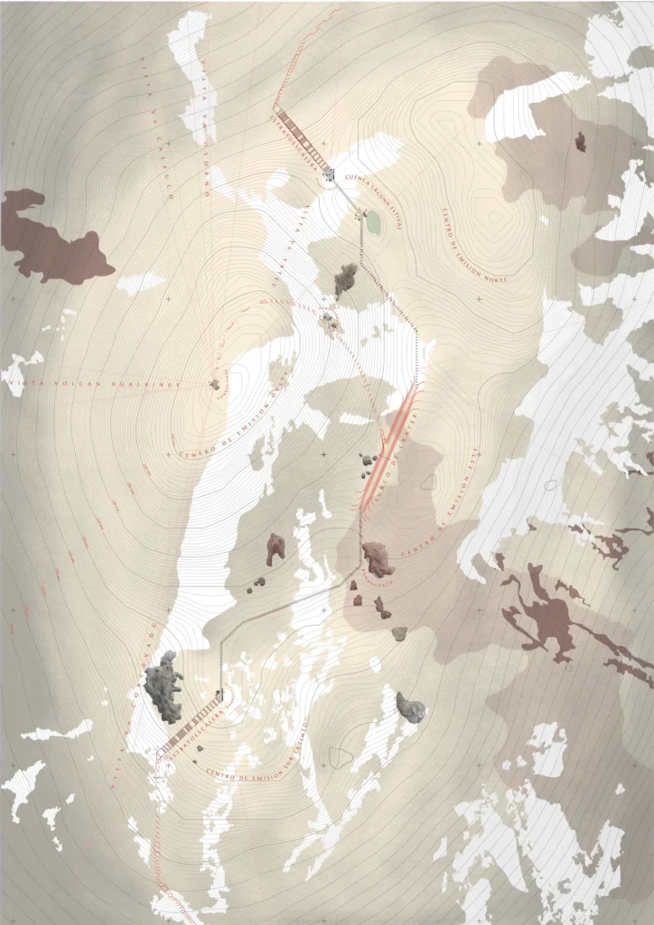
The project proposes a trail that ascends from the piedmont to the crater of the Hornopirén Volcano, conceived as a narrator of the geological history of the Austral Volcanic Landscape, of the Alerce (Fitzroya cupressoides) that grows on its soils, and of the Alerceros who deforested and inhabited it for centuries. The proposal is embedded within a broader territorial plan that establishes the North Patagonian Cycle Route and an Interconnected Network of Cycle Routes and Trails along the Hualaihué Peninsula, that aims to recover the transversality of the territory against the longitudinal logic imposed by the Carretera Austral since its construction.
View of the Hornopirén Volcano from kilometer 84 of the Carretera Austral.
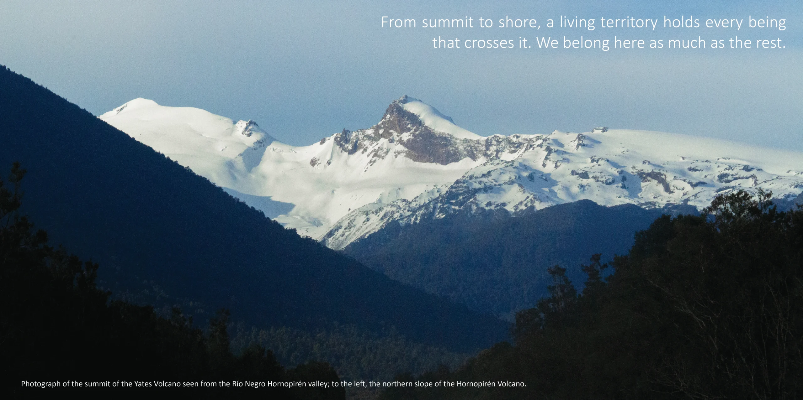
Long before maps named this region, the nomadic water peoples inhabited the channels, fjords, and estuaries of what would later be called Patagonia, a name itself born from the encounter with those the colonizers called patagones. Their bond with water endures in toponyms and in the working language of the Alercero, and their dwelling persists materially in shellmounds, where ground itself was built shell by shell along the fjord edges. This ancestral knowledge remains, and revisiting it becomes necessary to orient how we plan and intervene in a territory where each summit, basin, and volcano carries its own Genius Loci, places where the land itself feels sacred and the spiritual presence is too strong to ignore.
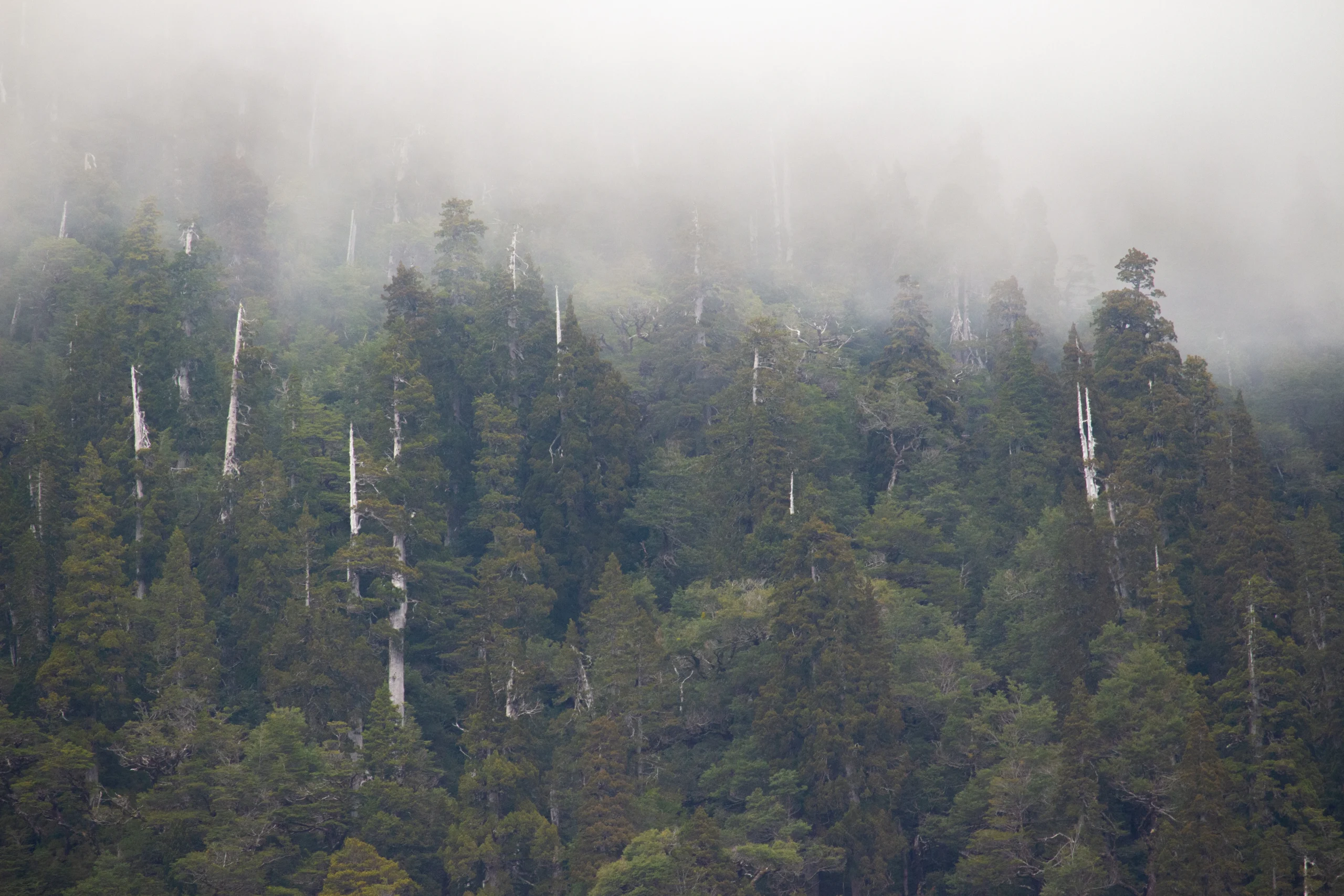
Photograph of Alerce trees in the Lake Cabrera basin, at the foot of the Hornopirén Volcano.Photograph of Alerce trees in the Lake Cabrera basin, at the foot of the Hornopirén Volcano.
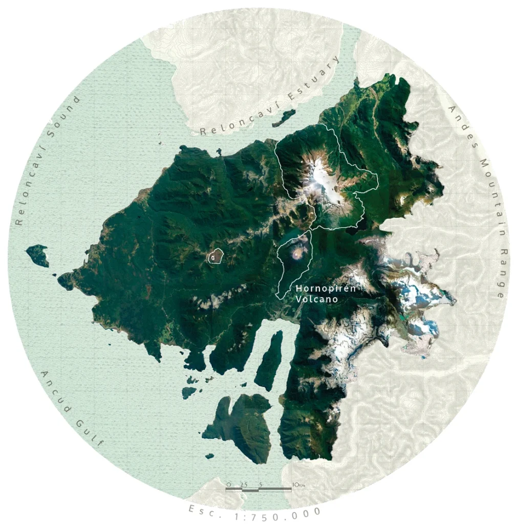
The Hualaihué Peninsula functions as the northern gateway to western Patagonia from the Reloncaví Estuary. It is a territory of high ecological and geological value whose identity has been shaped by centuries of inhabiting around the volcano, the forest, and the water. With the arrival of the Carretera Austral in 1976, the historically transversal flows between sea and mountain were replaced by a longitudinal north-south logic, weakening the bond between local communities and their own volcanoes.
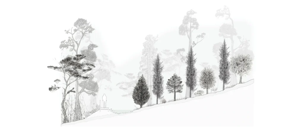
The territorial analysis is grounded in the construction of an ecological mosaic that reveals a fundamental triangulation: Volcano, Alerce (Fitzroya cupressoides), and Alercero. These three agents are historically linked by the trails traced by the latter, understood here not only as utilitarian infrastructure but as cultural traces that organize the comprehension of the landscape.
The figure of the Alercero constitutes the cultural pillar of the proposal. His empirical knowledge of the forest and navigation is systematized into precise operations that the project recovers and reinterprets: the recognition of the mancha, the alteo as a strategic lookout, the astillero as a first act of lightweight shelter, the tracing of the cuicuy as an exploration path, the picada as an orientation system, and the balsa tablera that articulates terrestrial and hydraulic routes. Today around ten Alerceros remain active, representing the last generation of this trade.
The Storytelling Heart of the Project
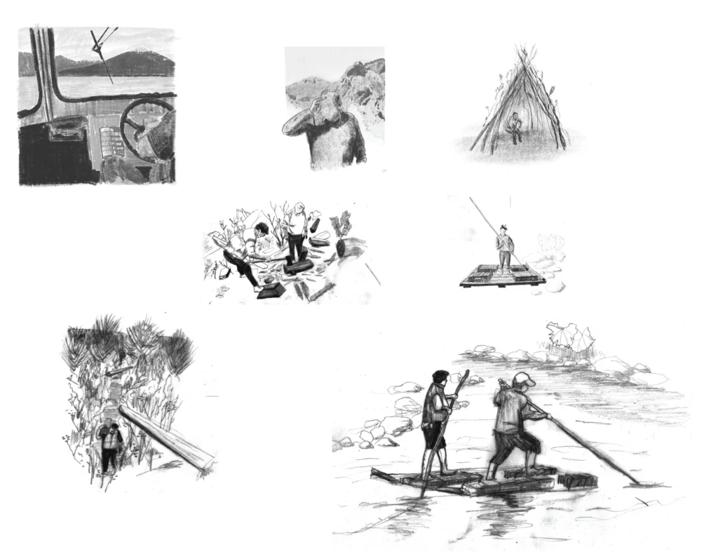
Illustrations of the acts performed by Alerceros in their inhabiting: the search for alerce patches in the landscape, the planning of trail layouts, the alerce logging work, orientation within the forest, the construction of the balsa tablera (plank raft), and the downstream retreat aboard it. Based on Urbina’s work and documentaries of the Hualaihué Peninsula.
The research also documents the types of Alerce recognized by the Alerceros in their own working language: Concañ, Mechung, Huinay, Cude, Pollera-quechu, Palo verde, Ala, Cude-petriu, Cude-Cude, Chanchui, Regañata, Huiñar, and Peñeng. This centuries-old vocabulary, at risk of extinction, is incorporated into the project as its linguistic and cultural substrate.
Also, The ecological reading recognizes the Hornopirén Volcano not as an eruptive event but as a cryptosystem: a volcanic landscape that evolves slowly, hidden beneath mantles of erosion, hydrographic networks, lithographic strata, and dense forests. Its geomorphology is structured in seven landscape units: Volcanic Piedmont, North Arm, South Arm, Central Truncated Cone Body, Volcanic Steppe, Crater Edge, and Crater Cones.
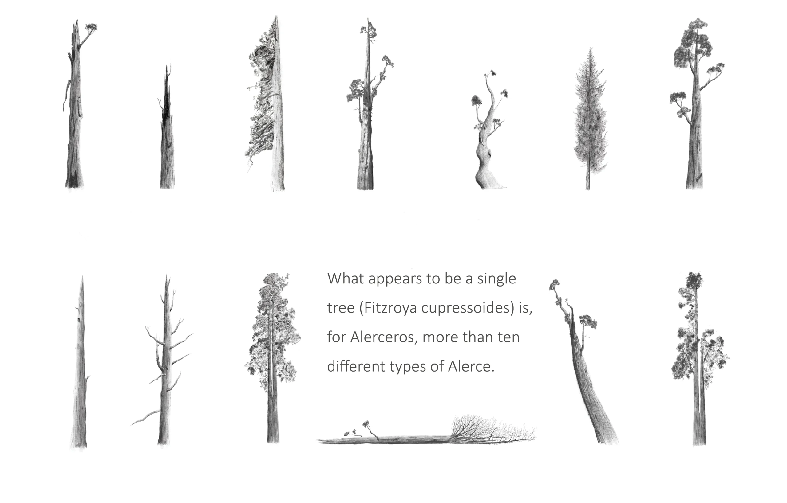
Illustrations of Alerce (Fitzroya cupressoides) types, interpreted from Análisis histórico-cultural del alerce en la Patagonia septentrional occidental, Chiloé, siglos XVI al XIX by Ximena Urbina, and from field studies and site visits.
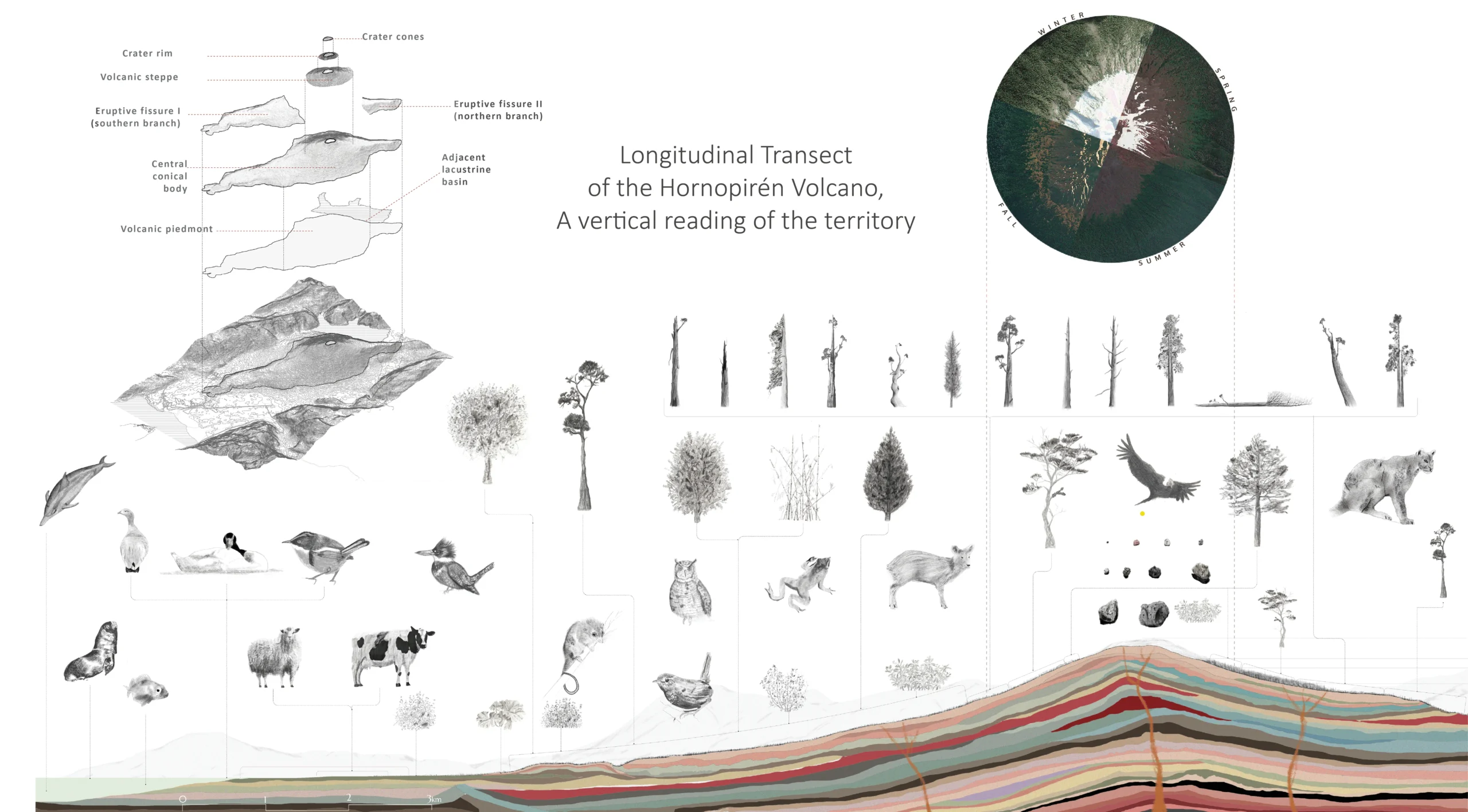
The mineralized and porous volcanic soil is also the ecological substrate of the Alerce, a threatened species classified as EN (Endangered), whose current remnants represent only 46% of the area existing i`n 1550, of which only 17% is under state protection. The Alerce, a long-lived conifer that can reach 50 meters in height and whose trunk grows only 0.6 to 1.6 mm per year, constitutes a mature ecosystem whose ecological importance stands at the level of the Amazon.The proposal responds with a trail that is simultaneously narrative infrastructure, ecological restoration device, and cultural recovery. It is structured in three moments: a Beginning through an Interpretive Center, a Development through a main Trail with a branch toward Lake Cabrera, and an End through the Crater Groove.
The layout applies an ascending logic of zig-zag and spiral that reduces by up to 40% the slope of existing trails traced against the contour, allowing the landscape to be traversed with greater comfort and lower erosive impact.
Beginning: Interpretive Center. Located on the volcanic piedmont, it is conceived as a synthesis of the entire transect condensed into a walkable distance. It incorporates a universal trail with maximum slopes of 2%, ensuring accessibility for people with reduced mobility and offering a first sensitive approach to the diversity of the landscape.
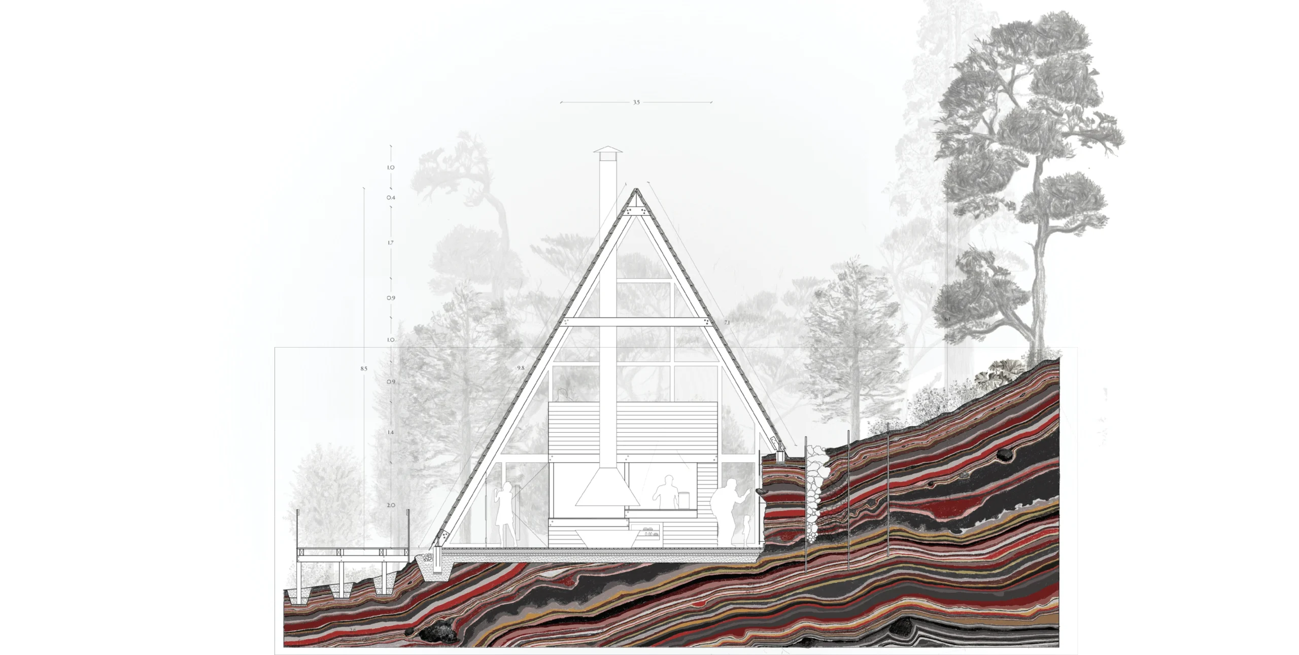
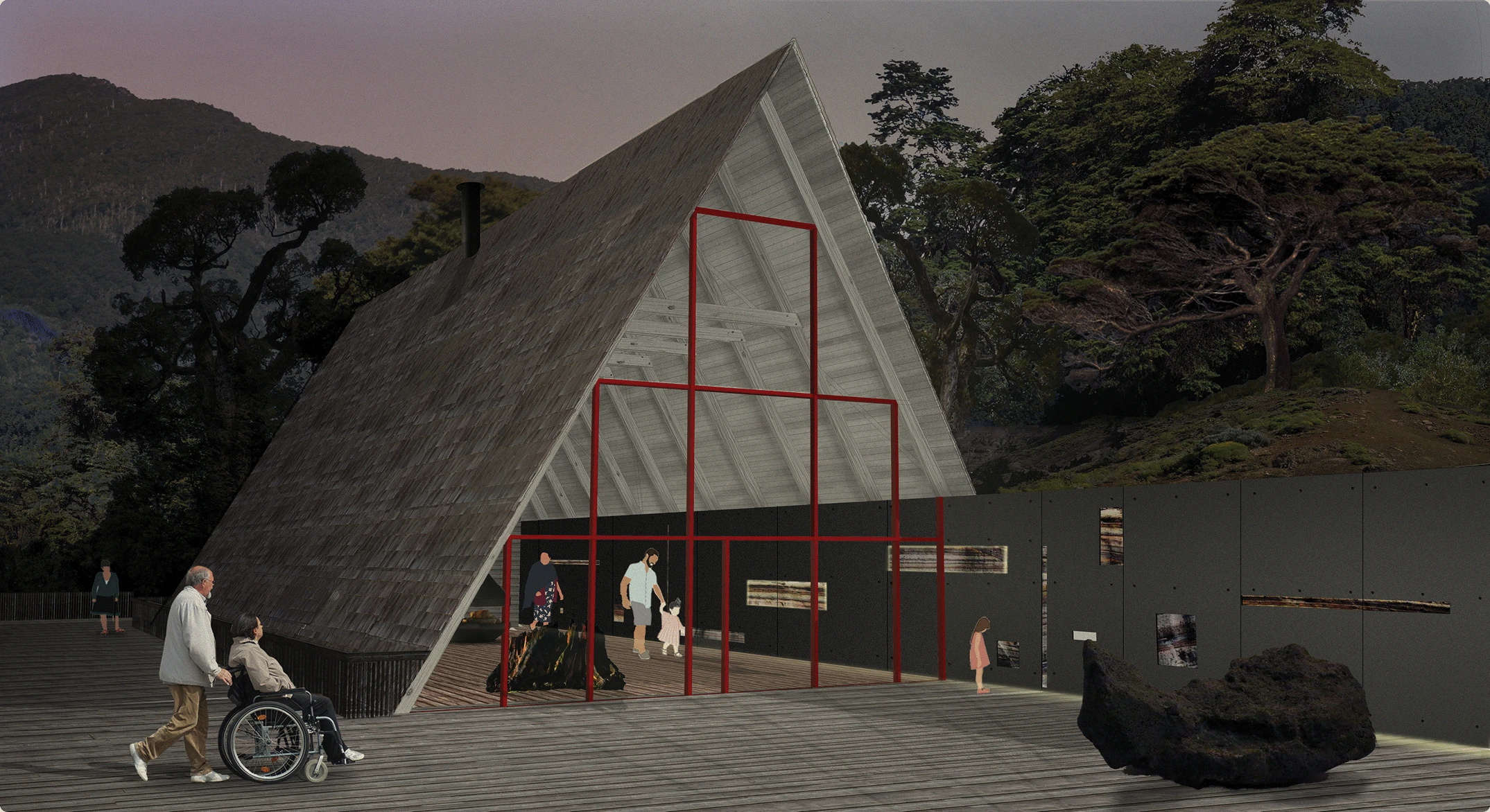
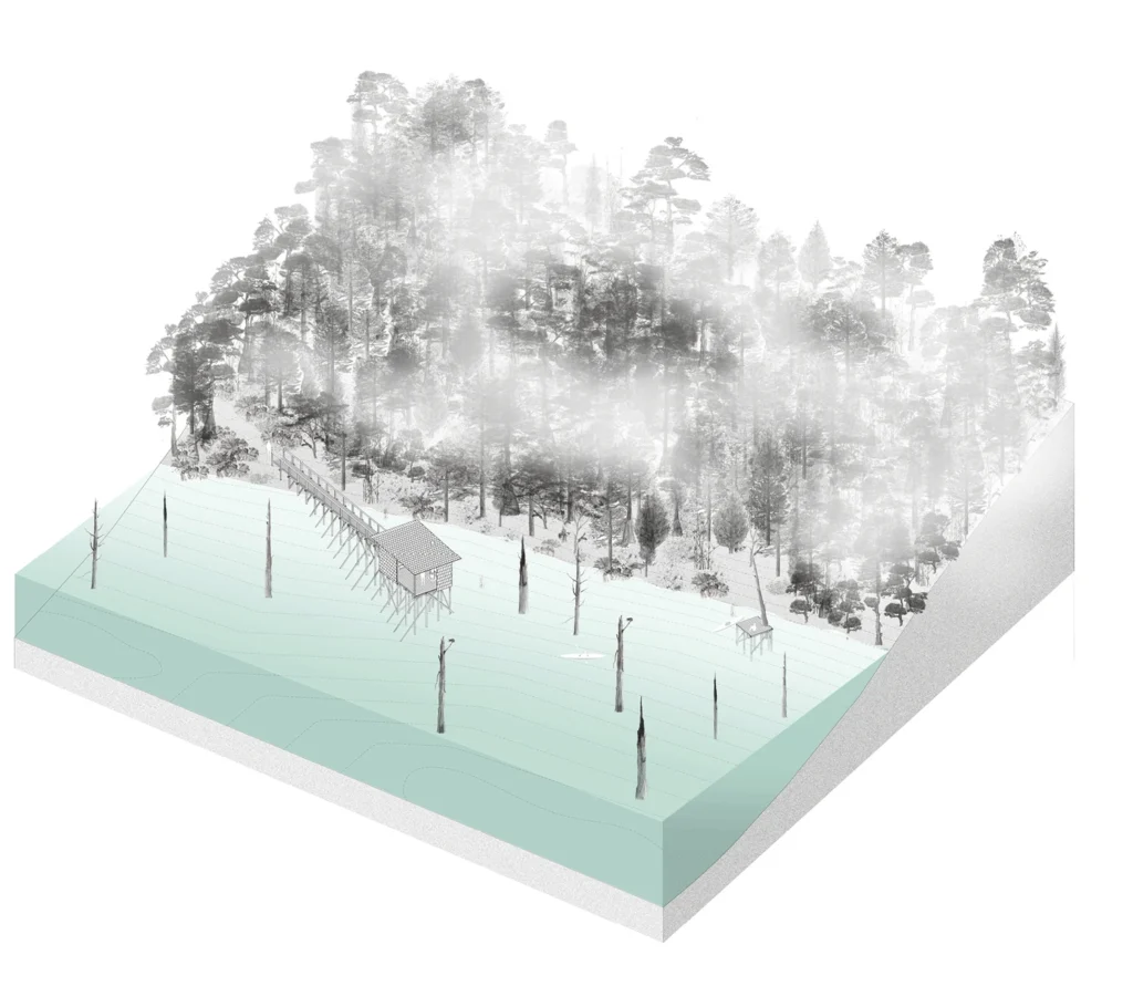
Development: Main Trail. Operates as active infrastructure, capable of elevating, sinking, or reinforcing itself according to ecological needs and user experience. In degraded zones, its layout forms small basins that manage surface runoff, reduce erosion, and favor water absorption, transforming the trail into an instrument of ecological restoration through Alerce recovery stepping stones. In other sections, the structure rises to reach the alerce canopy, transforming the trekking experience into a vertical perspective of the forest. In water bodies such as Lake Cabrera, the trail extends through submersible docks that adapt to lacustrine fluctuations.
Between each landscape unit, transition artifacts are placed that directly recover the operations of the Alercero’s inhabiting:
Mancha Artifact . Interpretive sign announcing the landscape reading
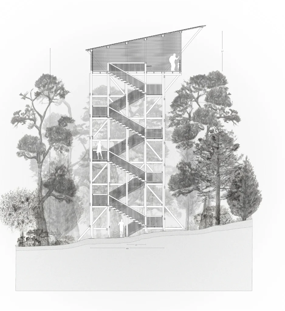
Alteo Artifact . Observation tower reinterpreting the act of scouting
Astillero Artifact. Lightweight shelter for rest and contemplation
Quelcuñe Artifact . Submersible navigation dock
Picada Artifact. Signage and orientation system
Plinto Artifact. Device to display Alerce types
Trunk-Stair. Vertical carved structure ascending to the canopyStrata-Stair. Exposing the tephra stratigraphy as geological narration
Alteo Artifact
Quelcuñe Artifact
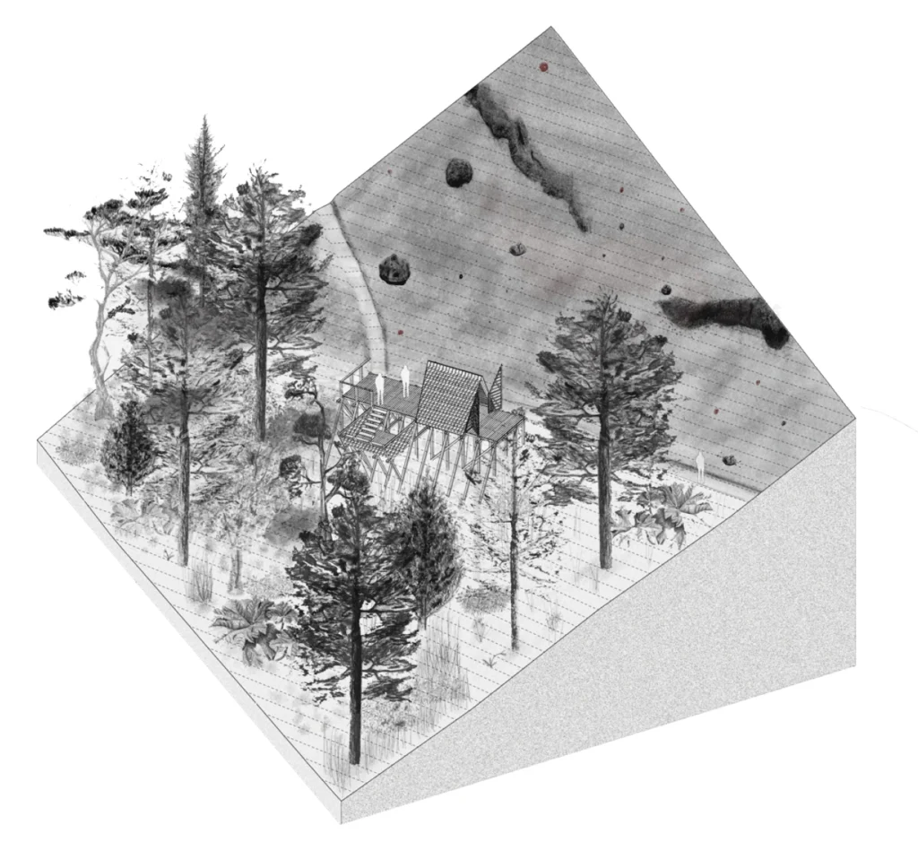
Astillero Artifact
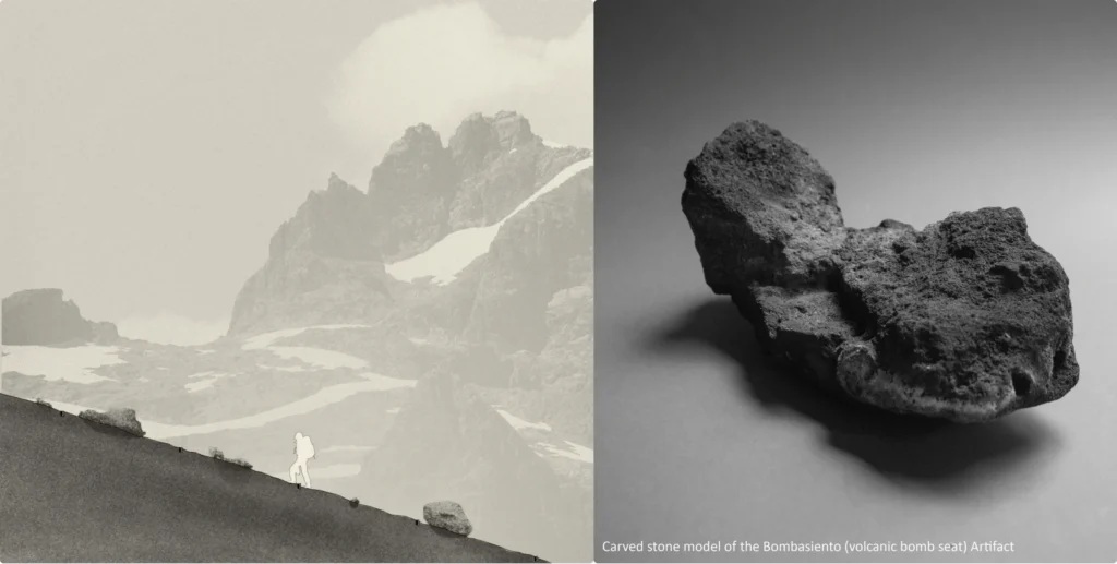
End: Crater Groove. A summit section with viewpoints and resting areas that exposes the final consolidated tephra layers and the entirety of the surrounding volcanic landscape, including the volcanoes of the Liquiñe-Ofqui fault.
The Lava and Water Trail proposes a model of responsible inhabiting for the Austral Volcanic Landscape, where landscape architecture takes on an active role in ecological restoration, the recovery of local knowledge, and the rebuilding of the sensory bond between inhabitant and territory. Facing Patagonia’s socio-ecological crisis, the project proposes a subtle and long-term form of intervention, where inhabitants, institutions, fauna, millenary trees, and volcanic rocks jointly participate in shaping the landscape.
This project corresponds to the Memoir submitted for the degree of Architect, developed at the Faculty of Architecture and Urbanism of the University of Chile (2021), under the guidance of Professor Paulina Fernández Lozier. The full document is available at the University of Chile Academic Repository. Ignacio Meneses A. DOI: 10.58011/vmf8-dh5
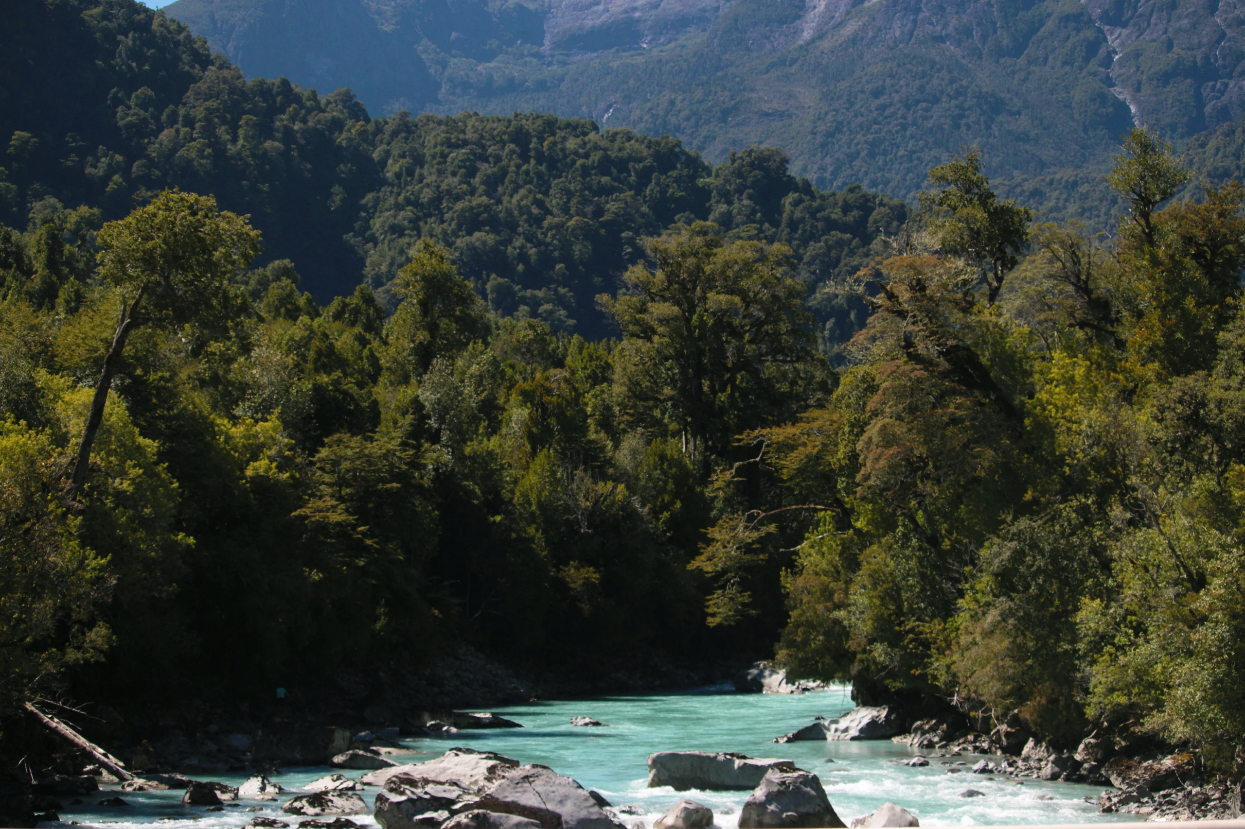
View from the bridge crossing the Río Blanco Hornopirén.